
International STEM Day: Indigenous wisdom and technology
We spoke with the Indigenous student who hopes to merge technology with ancestral wisdom.
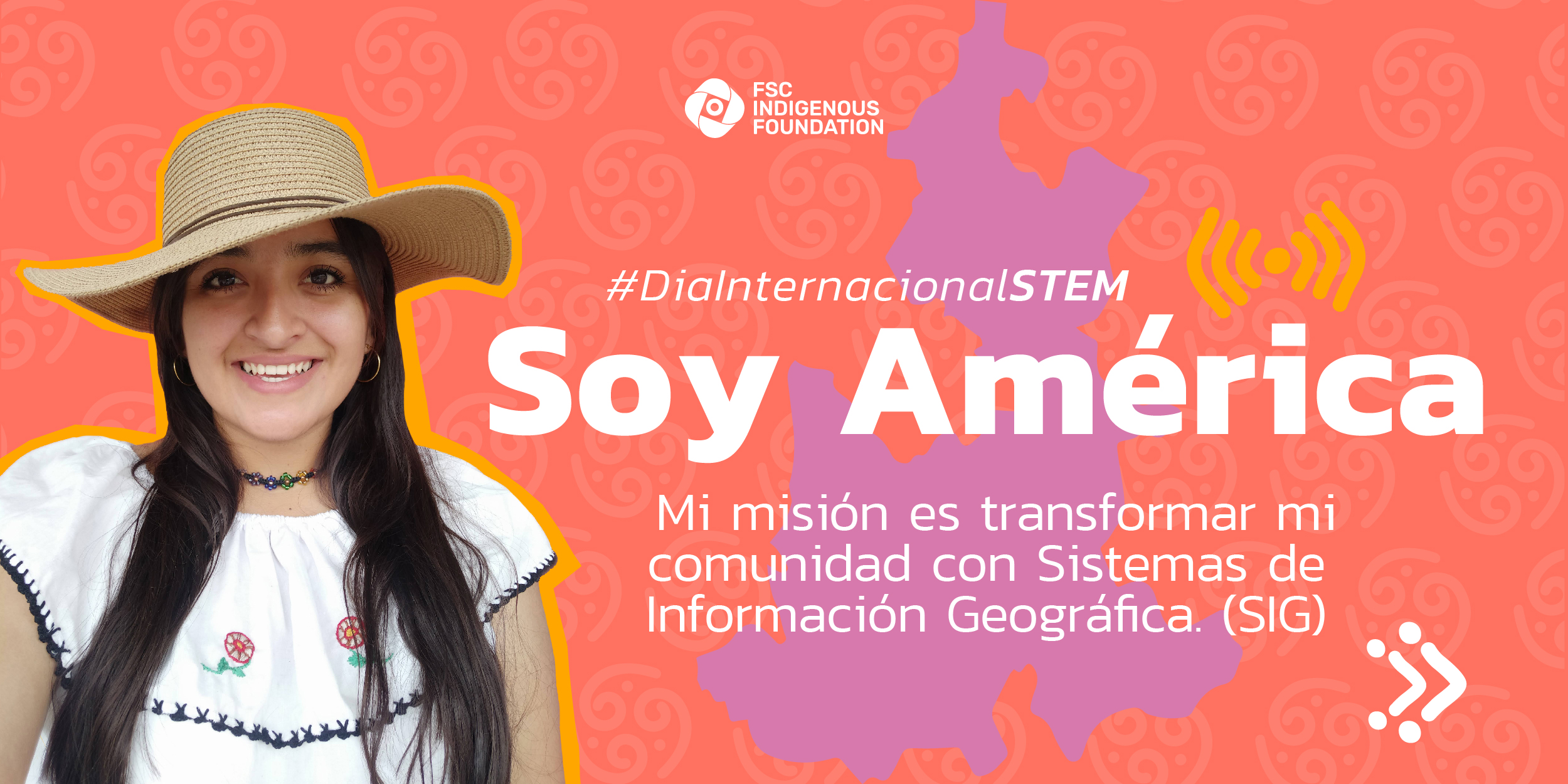
To celebrate International Science, Technology, Engineering and Mathematics (STEM) Day, we share the story of América Anayelli Olguín, a young Indigenous woman from Zacatlán, Mexico who will soon begin a postgraduate degree in Geographic Information and Science Systems, with the support of the FSC Indigenous Foundation through its IPARD program. America will study for a postgraduate degree at UNIGIS Latin America, in Geographic Information Systems, tools that allow capturing, storing, analyzing and visualizing geospatial data to make location-based decisions. This program has a high content related to the STEM educational approach that addresses the integration of knowledge through Science, Technology, Engineering and Mathematics. America’s goal is to apply geographic analysis for territorial development, agriculture, and environmental conservation in Indigenous territories.
In recent years, America has focused her work on documentation in defense of her territory and the dissemination of culture through social networks. Currently, she collaborates with the Union of Ejidos of the Sierra Norte de Puebla, where she supports local communities in the sustainable and legal use of their forests, and in their internal organizational processes. In addition, she is part of the network of communicators of the MOCAF Network and the youth movement of the Mesoamerican Alliance of Peoples and Forests. She is also an active member of the Regional Collective in Defense of Forests and Territory of the Sierra Norte de Puebla. Her contributions will have a significant impact, including the development of Land Management Plans and participatory rural assessments in support of forest communities in her region. Find out more about how Indigenous ancestral wisdom is combined with science for the benefit of communities in this interview.
What motivated your interest in this course to learn about GIS?
Given the area in which I have worked in recent years, in supporting local communities in their timber harvesting, I have discovered the great work that the communities of the region have done in the preservation and restoration of the environment, something that unfortunately is not recognized by the general population, which in many cases is usually from ignorance of the activities and benefits that community forestry brings. So I want to promote a dissemination campaign on this issue that will consist of presenting materials with geographic information that is easy to understand for everyone but contains truthful information and adequately expresses the message. I believe that when the population knows and understands its region, with all its characteristics, a first step is taken to defend the territory. Having the skills to process information with Geographic Information Systems can be a powerful tool to strengthen and support the process that communities carry out for this objective that we have in common in the Sierra Norte de Puebla.
What will you learn in the course?
The course will be both broad and complex; the topics that are of most interest to me are geographic analysis and how we can relate it to issues such as territorial development, agriculture, and the environment because they are day-to-day issues in my family and community.
How will you apply this knowledge in your community and beyond?
One of my goals is to disseminate what the forest communities of the Sierra Norte de Puebla are doing, so I hope to be able to apply my knowledge to support the communities in planning their development, for example with the development of Land Management Plans or Participatory Rural Appraisals; also to support them in obtaining financing or capacity building projects before Mexican government agencies, since it is increasingly complex for forest owners to access these supports.
How will you share the knowledge gained with the communities?
One way to support the communities is to give them the tools so that they can promote their projects and raise their voices. I can share the knowledge through the Mexican Network of Peasant Forestry Organizations (REDMOCAF) because, given the reach they have, we can promote projects for trainings with young people from all over the country who are members of the organizations that belong to the network.
Why do you think it is important for Indigenous Peoples to work in science and technology?
Bringing technology and traditions together can have many benefits, the first being the documentation of these traditions and an approach for Indigenous Peoples and local communities to monitor how their territory is developing and trending towards change.
How can GIS help Indigenous communities?
It helps to manage the resources we have which, with inherited knowledge, creates impact in the fight for the environment and climate change.
GIS are tools that allow us to chart a path to a future. With geographic information, we trace a legacy in maps, but also in culture and resilience. They also help us protect our lands and prepare for the natural challenges that life presents us because we are custodians of our home.
Do you have any other messages you would like to share?
GIS gives us the power to chart our own destiny, it gives us the ability to plan, build, and care so that future generations will inherit a world enriched by our traditions.
With the support of GIS, our voices are louder, and our decisions clearer. Together, we forge a future that protects the legacy we will leave to our descendants.
In short, GIS is a powerful tool that lights the way to firmly defend our territory and heritage in the Sierra Norte de Puebla. The knowledge you acquire in this course will be the foundation with which we will protect our land.